Category Archives: Ski Touring

OLD POST: NEWFOUNDLAND SPRING BREAK TRIP MARCH 2013

10_10
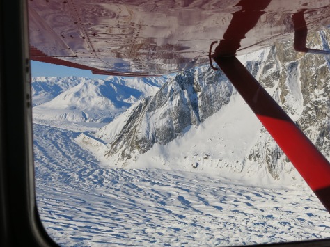
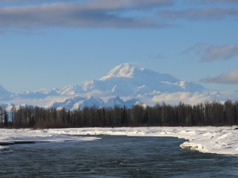
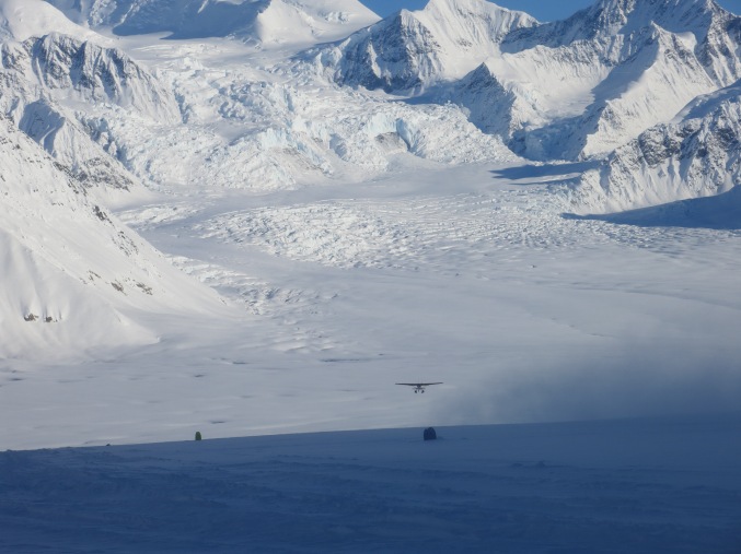
An old write up of a most wonderful trip I found on my laptop recently. Dedicated to the memory of Sean Collier.

Spring Break Newfoundland March 23 – 29 2013


Newfoundland is absolutely enormous, which is deceiving on map projections of the region where it is dwarfed by the Labrador mainland. With the short time we have in spring break we make a decision to concentrate on the attractions lying on the Western Part of the island. At the time of the trip (last week of March) most tourist attractions are also closed including many museums and the Viking ruins (as well as the ferry to the main city St John’s). National Parks and other places of scenery however do not close, and are completely empty waiting for us to see them. With this ambition we decide to set off to explore the land and culture by car for a week of hiking, camping, cross country skiing and adventuring.


Day I – Ferry to North Sydney


Departure time at 5 am from Boston to get to North Sydney ferry terminal. Google maps tells us it is a 14-hour drive, so we leave early to be there with plenty of time for boarding our ferry at 8 pm. Google maps however does not tell us about the one-hour time difference between here and Nova Scotia which is realized at Duncan Donuts on our way out of the city. This gives us about zero wiggle time for the journey – highly suggest checking this out before planning trips to Atlantic Canada!


Day II – Exploring Newfoundland’s South Western Coast

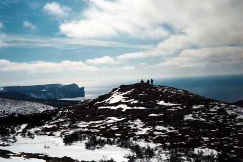
No one knows what to expect as the ferry pulls up to Port aux Basques. After a 14 hour drive in full snow and clouds through Nova Scotia I think there is a certain apprehension to the state of this much more northern territory. We arrive however to a beautiful and snowy crisp dawn greeting us at the port town. Newfoundland has been dubbed ‘the Rock’ and the reason becomes quickly obvious as we take in the cliffs and tall barren mountain tops.

The first leg of our journey is to head north in the direction of Stephenville, about 170 km away on the Trans-Canada highway. Stephenville is a small fishing village, and one of my personal favorites visited on the trip. You can get a sense that everyone in this town knows one another, and has a few memorable places including ‘Cafe Rendezvous’ where we met some of the nicest locals during our trip. Head here on Sundays for live local music, and speak to the owner who is a history teacher and can tell you all you need to know about the past of Newfoundland. You can also get a combination of local Newfoundland treats as well as Philippino cuisine.

The drive itself is fantastic to those just arriving in Newfoundland as you pass by the rugged topography. Following a period of glaciation the coast of Newfoundland is characterized by large and flat-topped mountains with dramatic cliffs dropping into the Atlantic. Driving toward Stephenville takes you through some of these mountains including the aptly named ‘Table Top’.

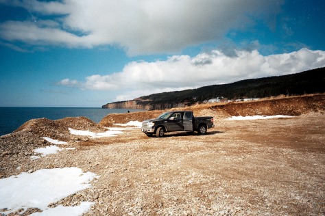
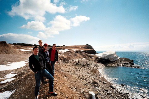
Around Stephenville interesting outdoor pursuits include a spit of land to the West of town called ‘Port au Port Peninsula’. Here you can walk for many kilometers on a beach along the spit with the rugged coastal scenery around you. On this same peninsula of land are a series of great cliffs for hiking on. Follow the road ‘463’ from the spit westwards to the hike ‘La Route de Mon Grand Pere’. This trail starts atop a cliff, and is marked by a small wooden panel on the side of the road. Easy to miss, but be sure not to as it gives fantastic coastal views from cliffs hundreds of feet above the ocean below.

Day III

From Stephenville Newfoundland’s highest mountain, the Cabox, standing tall 2,671 ft, is just half an hour away. It can be accessed by logging roads (Iglood Road) off of route 460. About a 45 minute drive along these roads places you at the bottom of the Cabox. A warning for those attempting access during snow cover: use chains and bring a shovel! Digging a Ford-150 out of the snow with trekking poles and ice axes makes for a long afternoon.

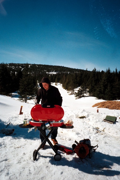
After the truck episode, we decide that there is not enough time to try and summit the Cabox. The logging trails around the base of the Cabox are however fantastic for both hiking and cross country skiing and provide a fantastic alternative. The area is also completely isolated and entirely our own, a wonderful way to experience Newfoundland’s highest peak.

3osfw7o9q6rnwxyaosnkejigc1256bbrbenrsnv4p30u1

Day IV


After a night spent outside of Deer Lake, we then head into Gros Morne National Park – the culminating point of our trip. We had heard from locals about Gros Morne’s beauty but I do not think we were quite prepared for how fantastic the park is. Located along the Western Coast, the park features fantastic open bays, beaches, cliffs, fjords and mountains. At this time of year all the tourist centers are closed. The adminstrative office at Rocky Harbor however stays open year round, and the park service here are immensely helpful with information on the trails and options available for exploration of the park in March.

A definite must-see is Western Brook fjord (and in fact is probably the image that appears the most on google searches of Gros Morne). A trail takes you through the fjord, however during the winter and seasons of high water, access is barred by a river. Nonetheless a great and flat walking trail takes you to a lake lying in front of the valley where you can still enjoy the dramatic landscape.

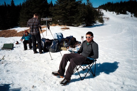
For the camping overnight of our trip, we decide to hike up the James Callaghan Trail to Gros Morne – Newfoundland’s second highest peak at 2,644 ft. Gros Morne which means ‘big lonely mountain’ is well named as this peak stands tall and apart from the rest of the landscape. Climbing Gros Morne offers great views of the entire park and ocean beyond, some of the loveliest seen during the trip. We are warned by the park service that ascent to the peak is ‘treacherous’ during the winter months, and not advised if the top cannot be seen. The trail diverges at ‘decision point’, 4 km from the parking lot, from which point the peak can be accessed by either a short steep ascent through a gully or a much longer journey which snakes around the side of the mountain. The shorter gully involves 500 meters of elevation gain over a very short distance making for a strenuous climb. During the winter, and particularly if you are not carrying crampons and ice axes, I would suggest taking the longer route!

Day V

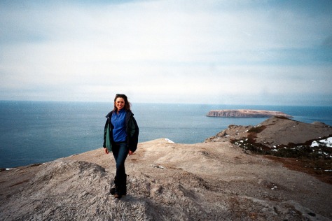
No visit to Gros Morne is complete without a visit to Green Gardens dubbed the ‘Galapagos of Geology’. The Green Garden short trail involves a 9 km hike to the coast and is accessed at the Long Pond trailhead which lies on route 431. This hike is mostly downhill all the way to the coast taking you throuh forest but with occasional peaks to the ocean below. The coastline here demonstrates the volcanic heritage of the island with its black stoned beach. It also features many sea stacks, arches, cliffs as well as lush green headlands. It is a wonderful place to explore with the only downside being that the entire route back to the car is uphill – so do not get too comfortable!


13

Day VI

After our tiring days in Gros Morne we opt for some more leisurely activities to finish off the trip. We spend the night at a campsite along Deer Lake before beginning our drive down back to the ferry the next day which is about 270 km drive. On the way we stop at Grand Codroy Provincial Park for a picnic on a beach with wide views of the surrounding cliffs. Another suggestion for if you also find yourself hanging out near Port Aux Basques with time on your hands is to explore the mountains in the area. We found a good logging trail to drive up to a radio tower.


04_4

8

A trip to the Don Sheldon Mountain House

DAY 0

In the midst of a busy semester during the middle of my PhD, I pack my bags for spring break. New York City has had an unusually mild winter, and so I do not mind that my plans are  taking me north to the cold of the Alaska Range. With anticipation I try to think of everything I will need for my week spent in the Mountain House. Although the cabin is comfortable and inviting compared to its stark surroundings, it is removed from Talkeetna, the closest town, by 150 miles of glacier, moraine, dense forest and meandering (now frozen) rivers.

The Don Sheldon Mountain House is a cabin which is described online as perhaps “the world’s most spectacularly-situated cabin”(1). True to this description, the Mountain House is precariously perched on a rocky outcrop lying in a sea of ice which feeds into the Ruth Glacier. Those who stay in the cabin are treated to a spectacular panorama with Denali looming to the north and the rest of the Ruth amphitheater extending in all directions. The cabin is only accessible by ski-plane and helicopter, which land on the adjacent glacier. A short hike up an exposed ridge takes guests to the Mountain House. In the summer months visitors are urged to be mindful of the crevasses forming in the vicinity of the house, a reminder of the active nature of the seemingly benign glacier underfoot.

We arrive in Talkeetna early Wednesday morning after a strenuous 275 mile drive from Fairbanks in a blizzard, progressing at a crawl of 30 mph. Descending a bend near Healy, we pass a car that has slipped into a ditch. A pickup truck on the scene is already assisting the unfortunate car and we crawl on. Perception of distance is oddly warped driving in Alaska’s interior. Healy lies over one hundred miles from Fairbanks, and after leaving Healy the next town, Cantwell, is another forty miles down the road. Save one or two small outposts, 127 miles later is our endpoint: Talkeetna. The sparsity of towns, lack of drivers in the early morning, and epic beauty of Denali Park shrink the five hour drive time hastening us to our destination.

IMG_8779

We pull into K2 aviation at around 10 a.m., and a light snow is falling in town. The expanse of Denali and the Alaska Range is hidden beneath a blanket of low cloud. Already anticipating the answer, we are told it is ‘no-fly’ weather and to try again in the afternoon. In the meantime we begin organizing our provisions to be weighed and checked for travel aboard the plane that will carry us up to the mountains: a 4-seater ski-equipped Cessna.

Things start to change and Denali appears looming tall and pink in the evening light. We meet our pilot – Chris – who has communicated with the Mountain House’s current guest a Mr. O. He is ready to come down after 6 days in the cabin. The weather forecasts are less optimistic indicating strong winds. This aside, we get prepared anyway to at least circle the cabin and attempt landing.

Not an easy flyer, I am apprehensive as I get into the front seat of the plane. I am shoulder to shoulder with our pilot, and the back of the aircraft is brimming with our skis, packs and other provisions for our stay. However, as soon as we take off the beauty and majesty of the scenery have an instant calming effect. Rising up over the tundra and spruce forests surrounding Talkeetna, the landscape is pristine. Braided rivers, frozen and snow-covered, meander across the land. Animal tracks are visible, and at one point we spot a moose.

IMG_8816

The view of Denali in the distance steals the show. Formed over 65 million years ago by the uplift of erosion-resistant granite, Denali, meaning the ‘high one’, dwarfs surrounding peaks with its behemoth proportions. Rising 18,000 feet from the plain, Denali can be considered taller than Mt Everest in terms of vertical relief (3). As we approach the mountain, clouds still clinging to its lower flanks produce temporary ‘bumpy air’. Our pilot then enters the gorge incised by the Ruth Glacier which runs 40 miles long and attains thicknesses of up to 4000 feet. As we fly over the moraine, a region in which the sediment carried by the glacier becomes exposed at the surface at its terminus, sunken areas the size of football feeds demonstrate collapse. Granite blocks the size of houses litter the terrain. Further into the gorge, the surface becomes heavily crevassed. Our pilot tells us these older crevasses can be 3000 to 4000 feet deep.

IMG_8983.JPG

As we gain altitude and approach the mountain house, granite cliffs rise on both sides of our Cessna, casting a shadow and blocking views of the valley below. The cliffs rise 5000 feet above the base of the glacier, 2000 feet taller than El Capitan. Smaller valleys emerge from breaks in this granite corridor, leading to ice falls and eroded peaks. Finally we emerge into the Don Sheldon (or Ruth) Amphitheater, in which ice flows from all sides to feed into the main stem of the Ruth glacier. The area resembles an outstretched hand, with each finger pointing to some distant granite peak or ice fall, separated by over 40 miles.

Circling back now in the plane, we get our first view of the Don Sheldon Mountain House. A small hexagonally shaped wooden cabin impossibly situated in the midst of this isolation and grandeur.The cabin was built by bush pilot and adventurer Don Sheldon in 1966. Don Sheldon was made famous for pioneering glacial landings in the Alaska Range, which now forms the basis of a thriving business in Talkeetna. From spring to fall, bush planes drop off both climbers and tourists high on the flanks of impossibly wild terrain. During World War II Don Sheldon lent his aviation skills to flying as a gunner in a B-17 Flying Fortress Crew over Europe where he received several military distinctions (2).

The Mountain House is located halfway up one of the valleys feeding into the Ruth amphitheater, flanked by two glaciers on either side of the rocky outcrop and shadowed by Mt. Barill which rises behind it. Glaciers are also known to generate their own wind systems which are in turn funneled by the sharp valleys. We experience this as Chris loops back for a test landing – and then reconsiders as the plane is jolted in the 20 knot winds. Below we see Mr. O outside the cabin. Sadly for both him and us, we will not be landing this time round. Making this decision, our adventure is delayed by one day. We return to Talkeetna and enjoy the sunset and the distant views of our hopeful mountain conquests.


IMG_8941

(1) http://www.alaska.org/detail/don-sheldon-mountain-house
(2) https://en.wikipedia.org/wiki/Donald_Sheldon
(3) https://www.nature.nps.gov/geology/parks/dena/


DAY 1


Thursday we wake up to a clear view of Denali, and eagerly head back to K2 aviation.We are introduced to Chip who is our pilot today. After a last minute check of our belongings, we are ready to go and clamber back into the Cessna. Yesterday’s short flight has wetted my appetite for bush planes and I am eager to be airborne again. The morning is clear and beautiful and Denali grows before with an orange hue. Through the headset, Chip describes how he began with flying hunters and fisherman out to remote locations, landing on lakes and open fields. Possibly not as lucrative as commercial flying, perks of this employ included generous shares in their kill. A single moose can yield upwards of 600 lbs of meat, which the hunters divided with Chip in payment.

Perhaps it is the unforgiving climate, nature, and inherent dangers faced by Alaskans venturing into the remote wild, but a strong culture of camaraderie is prevalent in this state. Chip relates how part of the share of meat he received from hunters he would give to the elderly living in the remote villages, who are now too senior to hunt for themselves. This tradition of provision and caring for the community although extant today, appears to be diminishing, laments Chip.

As we approach the Mountain House the view is just as stunning the second time around. The American flag visible from the plane, and mounted on a small shed near the house, hangs motionless. This is in direct contrast to yesterday’s flyby where the strong winds rippled through the flag as it strained to remain on its post. Chip fills us in on another piece of Mountain House history during the final reaches of the flight. Motivated by the Alaskan heritage of the gold rush, Don Sheldon originally envisioned the Mountain House as a site for mining of precious minerals. Although this ambition was not realized, in its stead the Mountain House became a great site for parties and entertaining, which Don Sheldon would hold on a regular basis.

This time we are able to land. Half a foot of snow has fallen since the last landing, and the Cessna makes a slight ‘thump’ as it gently lands on the freshly powdered glacier. Mr. O is ready to be finally picked up, and we happily exchange places with him. After unloading the plane, we begin one of multiple journeys hauling our gear up to the cabin using the trail Mr. O has just cut into the deep fresh snow. As we carry out our trips up and down the slope leading to the Mountain House, we hear the plane’s propeller below turn on. Looking back, the plane starts its take off on the glacier runway. After impossibly short contact with the ground, the plane glides off the slope of the mountain, dipping first toward the amphitheater below before rising up and disappearing down glacier into the gorge, leaving us alone with the silence of the mountains.

IMG_9048

IMG_9053