 An old write up of a most wonderful trip I found on my laptop recently. Dedicated to the memory of Sean Collier.
Spring Break Newfoundland March 23 – 29 2013
Newfoundland is absolutely enormous, which is deceiving on map projections of the region where it is dwarfed by the Labrador mainland. With the short time we have in spring break we make a decision to concentrate on the attractions lying on the Western Part of the island. At the time of the trip (last week of March) most tourist attractions are also closed including many museums and the Viking ruins (as well as the ferry to the main city St John’s). National Parks and other places of scenery however do not close, and are completely empty waiting for us to see them. With this ambition we decide to set off to explore the land and culture by car for a week of hiking, camping, cross country skiing and adventuring.
Day I – Ferry to North Sydney
Departure time at 5 am from Boston to get to North Sydney ferry terminal. Google maps tells us it is a 14-hour drive, so we leave early to be there with plenty of time for boarding our ferry at 8 pm. Google maps however does not tell us about the one-hour time difference between here and Nova Scotia which is realized at Duncan Donuts on our way out of the city. This gives us about zero wiggle time for the journey – highly suggest checking this out before planning trips to Atlantic Canada!
Day II – Exploring Newfoundland’s South Western Coast
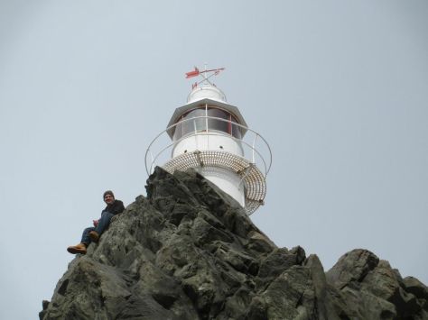
No one knows what to expect as the ferry pulls up to Port aux Basques. After a 14 hour drive in full snow and clouds through Nova Scotia I think there is a certain apprehension to the state of this much more northern territory. We arrive however to a beautiful and snowy crisp dawn greeting us at the port town. Newfoundland has been dubbed ‘the Rock’ and the reason becomes quickly obvious as we take in the cliffs and tall barren mountain tops.
The first leg of our journey is to head north in the direction of Stephenville, about 170 km away on the Trans-Canada highway. Stephenville is a small fishing village, and one of my personal favorites visited on the trip. You can get a sense that everyone in this town knows one another, and has a few memorable places including ‘Cafe Rendezvous’ where we met some of the nicest locals during our trip. Head here on Sundays for live local music, and speak to the owner who is a history teacher and can tell you all you need to know about the past of Newfoundland. You can also get a combination of local Newfoundland treats as well as Philippino cuisine.
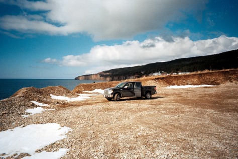
The drive itself is fantastic to those just arriving in Newfoundland as you pass by the rugged topography. Following a period of glaciation the coast of Newfoundland is characterized by large and flat-topped mountains with dramatic cliffs dropping into the Atlantic. Driving toward Stephenville takes you through some of these mountains including the aptly named ‘Table Top’.
Around Stephenville interesting outdoor pursuits include a spit of land to the West of town called ‘Port au Port Peninsula’. Here you can walk for many kilometers on a beach along the spit with the rugged coastal scenery around you. On this same peninsula of land are a series of great cliffs for hiking on. Follow the road ‘463’ from the spit westwards to the hike ‘La Route de Mon Grand Pere’. This trail starts atop a cliff, and is marked by a small wooden panel on the side of the road. Easy to miss, but be sure not to as it gives fantastic coastal views from cliffs hundreds of feet above the ocean below.
Day III
From Stephenville Newfoundland’s highest mountain, the Cabox, standing tall 2,671 ft, is just half an hour away. It can be accessed by logging roads (Iglood Road) off of route 460. About a 45 minute drive along these roads places you at the bottom of the Cabox. A warning for those attempting access during snow cover: use chains and bring a shovel! Digging a Ford-150 out of the snow with trekking poles and ice axes makes for a long afternoon.
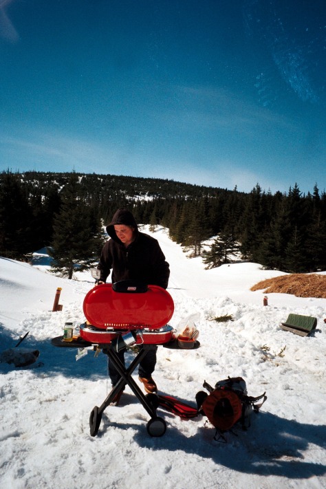
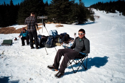
After the truck episode, we decide that there is not enough time to try and summit the Cabox. The logging trails around the base of the Cabox are however fantastic for both hiking and cross country skiing and provide a fantastic alternative. The area is also completely isolated and entirely our own, a wonderful way to experience Newfoundland’s highest peak.
Day IV
After a night spent outside of Deer Lake, we then head into Gros Morne National Park – the culminating point of our trip. We had heard from locals about Gros Morne’s beauty but I do not think we were quite prepared for how fantastic the park is. Located along the Western Coast, the park features fantastic open bays, beaches, cliffs, fjords and mountains. At this time of year all the tourist centers are closed. The adminstrative office at Rocky Harbor however stays open year round, and the park service here are immensely helpful with information on the trails and options available for exploration of the park in March.
A definite must-see is Western Brook fjord (and in fact is probably the image that appears the most on google searches of Gros Morne). A trail takes you through the fjord, however during the winter and seasons of high water, access is barred by a river. Nonetheless a great and flat walking trail takes you to a lake lying in front of the valley where you can still enjoy the dramatic landscape.
For the camping overnight of our trip, we decide to hike up the James Callaghan Trail to Gros Morne – Newfoundland’s second highest peak at 2,644 ft. Gros Morne which means ‘big lonely mountain’ is well named as this peak stands tall and apart from the rest of the landscape. Climbing Gros Morne offers great views of the entire park and ocean beyond, some of the loveliest seen during the trip. We are warned by the park service that ascent to the peak is ‘treacherous’ during the winter months, and not advised if the top cannot be seen. The trail diverges at ‘decision point’, 4 km from the parking lot, from which point the peak can be accessed by either a short steep ascent through a gully or a much longer journey which snakes around the side of the mountain. The shorter gully involves 500 meters of elevation gain over a very short distance making for a strenuous climb. During the winter, and particularly if you are not carrying crampons and ice axes, I would suggest taking the longer route!
Day V
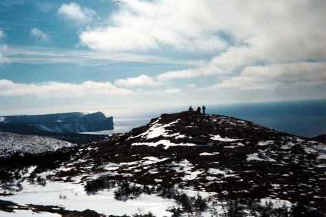
No visit to Gros Morne is complete without a visit to Green Gardens dubbed the ‘Galapagos of Geology’. The Green Garden short trail involves a 9 km hike to the coast and is accessed at the Long Pond trailhead which lies on route 431. This hike is mostly downhill all the way to the coast taking you throuh forest but with occasional peaks to the ocean below. The coastline here demonstrates the volcanic heritage of the island with its black stoned beach. It also features many sea stacks, arches, cliffs as well as lush green headlands. It is a wonderful place to explore with the only downside being that the entire route back to the car is uphill – so do not get too comfortable!
Day VI
After our tiring days in Gros Morne we opt for some more leisurely activities to finish off the trip. We spend the night at a campsite along Deer Lake before beginning our drive down back to the ferry the next day which is about 270 km drive. On the way we stop at Grand Codroy Provincial Park for a picnic on a beach with wide views of the surrounding cliffs. Another suggestion for if you also find yourself hanging out near Port Aux Basques with time on your hands is to explore the mountains in the area. We found a good logging trail to drive up to a radio tower.
